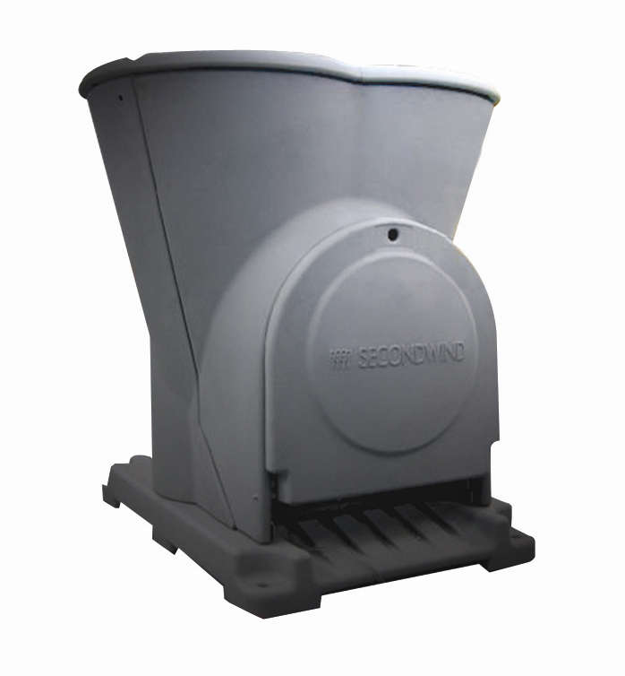
 Vaisala says that its Triton Wind Profiler is as accurate for wind resource assessment applications as a traditional met tower – and it has the findings to prove it.
The study – conducted by the Vaisala 3TIER Services wind resource assessment team – evaluated more than 50,000 hours of wind data gathered from customer sites on four continents. The study compared data measured by Triton with data collected from collocated met towers. Rather than focusing on a single met tower and a single remote sensor, Vaisala says the study analyzed both technologies in real commercial deployments across a range of weather regimes and geographic locations over extended periods.
According to Vaisala, the findings suggest that remote sensing technology has caught up to traditional met towers – the tried-and-true method to evaluate a wind site's potential.
Wind industry remote sensing technologies, such as LIDAR or SODAR, employ light waves or sound waves to measure wind conditions at the heights where most wind turbines now operate. During the last decade, remote sensing systems have complemented met tower findings. Now, the company insists that such technology has emerged as a viable alternative.
As the wind industry has matured, taller wind turbines with longer blades have been introduced to improve efficiency by taking advantage of stronger winds at higher heights. ‘This means that the turbines have, quite literally, outgrown the met towers that have been the standard form of wind measurement used to finance wind development,’ says Mark Stoelinga, senior scientist at Vaisala and the study's primary author.


