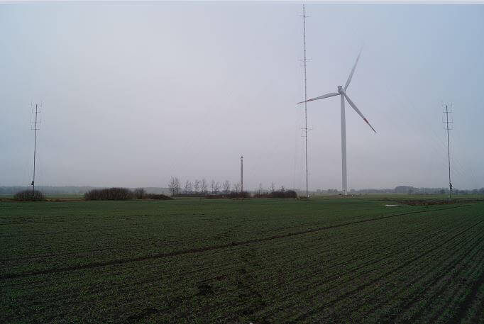
DNV GL has announced the successful verification of two nacelle-based LiDAR systems at the company’s test site in Janneby, Germany. The campaigns included the verification of an Avent WindIris 4-beam, as well as a ZephIR DM LiDAR system.
According to DNV GL, the test site near the Baltic Sea provides optimal wind conditions for the verification of the wind measuring systems; more than half of the company’s 100 LiDAR vertifications have been conducted at the Janneby test site. Developed by DNV GL, Bürgerwindpark Janneby and GEO Gesellschaft für Energie und Oekologie, the site has an accredited test laboratory for ground-based LiDAR verifications according to DIN EN ISO/IEC 17025:2005.
“Remote sensing technologies, especially LiDAR systems, are becoming increasingly important in the wind industry,” states Andreas Schröter, executive vice president for central Europe and Mediterranean at DNV GL. “Since 2005, we have been at the forefront of performing ground-based measurements and verifications. Now, we have extended our test site in Janneby and are pleased to announce the successful completion of the first two nacelle-based LiDAR system verifications.”
For traceable field measurements, the accuracy of the LiDAR system has to be determined by an independent service provider and evaluated in accordance with international standards and guidelines, the company explains. The 30-meter masts at the site permit the alignment of nacelle-based LiDAR systems in a similar way that they are used on a wind turbine.
In general, for nacelle-based LiDAR systems, DNV GL takes three different input parameters into account: radial wind speed, scan geometry, and inclinometers (tilt and roll angles).


